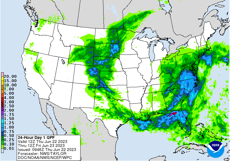
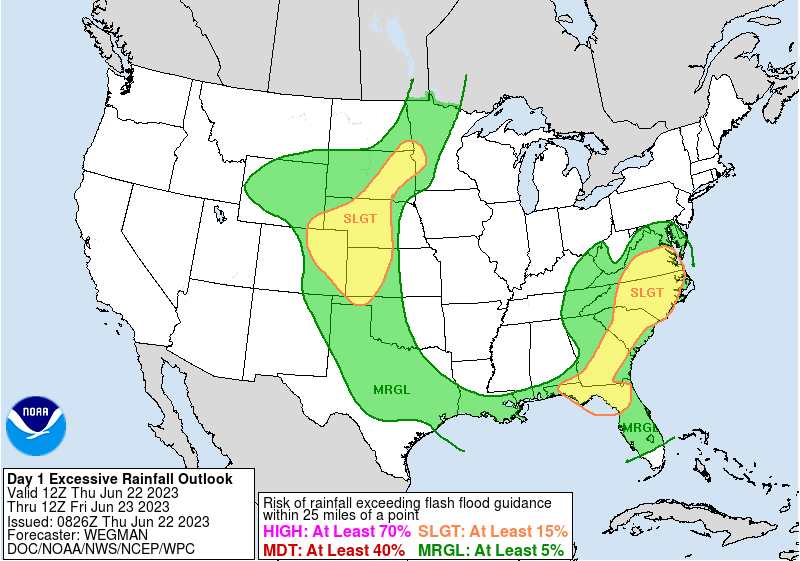
Excessive Rainfall Discussion
NWS Weather Prediction Center College Park MD
427 AM EDT Thu Jun 22 2023
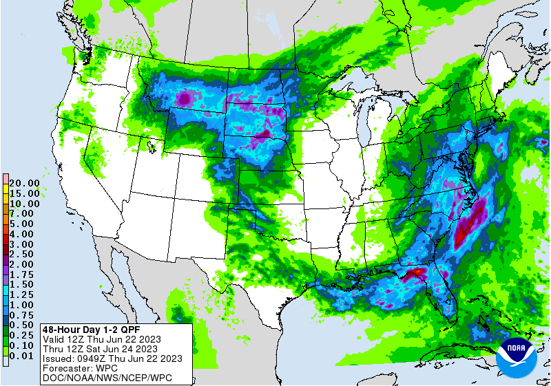
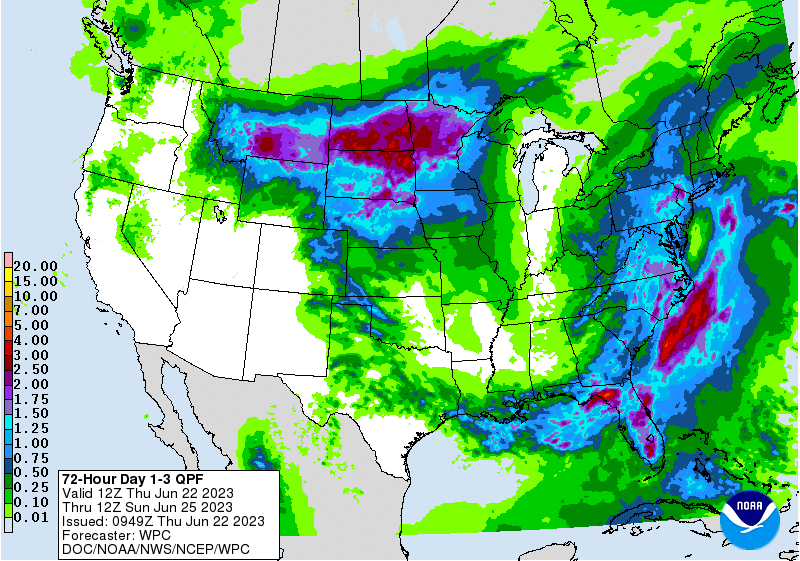
Day 1
Valid 12Z Thu Jun 22 2023 - 12Z Fri Jun 23 2023
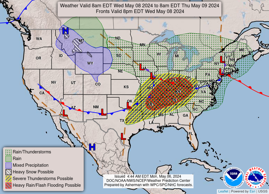
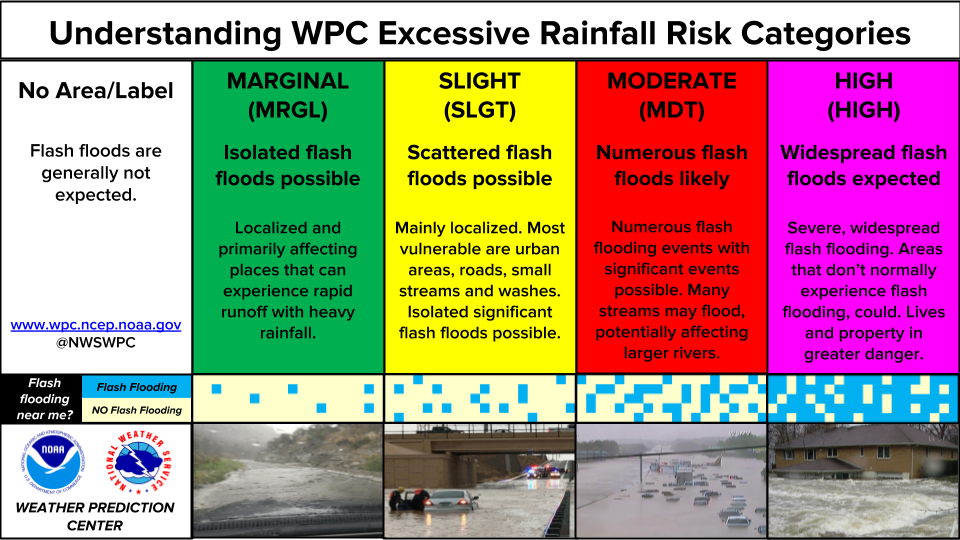
...THERE IS A SLIGHT RISK FOR EXCESSIVE RAINFALL FOR PORTIONS OF
THE SOUTHEAST AND HIGH PLAINS...
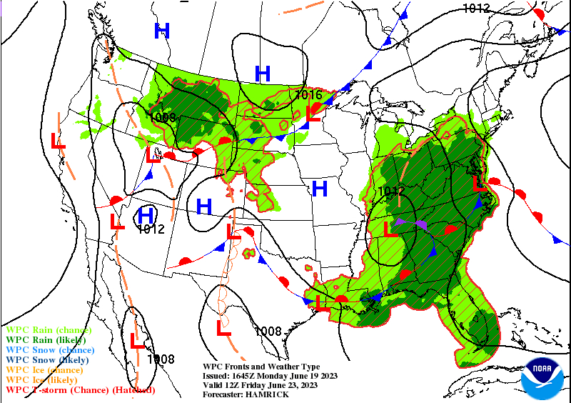
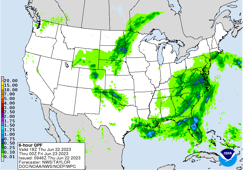
...Southeast...
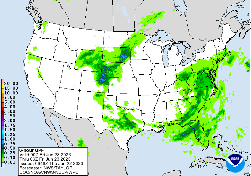
The vertically stacked low over the Tennessee Valley this morning
will slowly drift northward into the Ohio Valley by Friday
morning. As it does so, it will continue pumping plentiful Gulf
moisture northward up the Eastern Seaboard and into New England.
Meanwhile, shortwave disturbances wrapping around the low will
remain prolific at supporting additional rounds of showers and
thunderstorms across the area. Both their slow movement and
abundance of available moisture will support heavy rains that
could cause additional flash flooding. The Slight Risk area is
considered a high-end one in three separate portions of the Slight
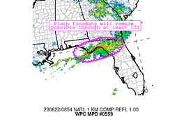
risk area. Starting in the south, the eastern Florida Panhandle
through the Big Bend area will likely see yet another round of
slow moving and backbuilding storms that will train over the same
areas being hard-hit now and have been for the past several days.
With no relief in sight in this area, and despite the high
thresholds for flash flooding which include the very favorable
antecedent conditions, the expected storms are likely to result in
flash flooding yet again. The ongoing MCS over the area will
gradually weaken through the afternoon, with many areas of north
FL getting a brief break in the storms, but by afternoon the
storms will redevelop over the Gulf and track over the Big Bend
area again, taking well into the evening to finally drift far
enough south to allow for a longer break in the rainfall. The area
from east of Tallahassee to Gainesville has seen anywhere from
200-350% of their normal rainfall over the last 2 weeks according
to AHPS data, so soils in the area cannot handle any more rainfall.
Further north across south GA, an advancing front trying to bring
a bit drier air to the region behind the low will force another
round of storms to develop ahead of it across this region. Just
like down in FL, this area has seen 200-400% of normal rainfall
over the past 2 weeks, and over the last week over 600% of normal
towards Albany. Most of the guidance is hinting that the area of
rain will be just south and east of Albany, but rainfall amounts
there are still 200-400% of normal over the past week, so soils in
this region are also very saturated. The front will help to move
the storms along towards the northeast, so fortunately no one area
will see stationary convection get stuck, but since the front will
be stalling out, it will act as a corridor for storms to train
over many of the same areas over and over again. General consensus
is for the storms to develop in the late afternoon, around 20Z,
and persist through around midnight.
Finally up towards the central Carolinas and southern VA,
scattered showers and thunderstorms will be ongoing at the start
of the period and continue well into the overnight tonight. The
most organized convection will be in the morning associated with
an upper level shortwave rotating around the low, becoming more
widely scattered through the afternoon and overnight as the storms
pop up and quickly move northward. While training convection is
likely, the timing between individual storms will vary widely
across this region. The Slight risk was maintained across the
Carolinas, which have seen upwards of 200% of normal rainfall over
the past week, and are therefore more susceptible than up into
southern VA. The Slight risk area was expanded northward into
southern VA to include Richmond and the Hampton Roads area due to
locally lower FFGs due to urbanization and recent rainfall in this
area. As with areas further south, moisture will remain plentiful
with most areas staying at 1.75 inches PWATs, or up to 2 sigma
above normal.
...Plains...
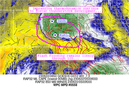
In CO, the ongoing convection at the time of this writing will
continue moving slowly eastward across the High Plains in the
eastern part of the state. These storms have been responsible for
numerous Flash Flood Warnings, several of which have are
highlighting considerable flash flooding. Once this MCS finally
moves off and begins turning southward into KS, there may be a
break in CO for some of the morning hours. With daytime heating
however, new storms are likely to develop along the Front Range,
but fortunately should by this point be moving eastward fast
enough to make the flash flooding threat considerably lower than
last night. Nonetheless, the storms will continue to have ample
moisture and the local dry line will provide additional forcing,
so the storms are likely to be strong, even if they're more
isolated than previous days. Given the ample rainfall the area has
seen with parts of CO between Denver and Colorado Springs seeing
over 600% of normal rainfall the past 2 weeks, any storms even if
more isolated and faster moving have potential to result in
localized flash flooding.
Northeast of there into South Dakota, a cool front will be
advancing southeastward out of MT and ND. Ample Gulf moisture from
a strong 40 kt LLJ will supply the storms with plenty of energy.
The storms will develop in the late afternoon and continue into
the evening as they organize into an MCS over eastern SD. While
this area hasn't had nearly as much rain as eastern CO has, there
is good potential for training and repeating storms as the MCS
grows upscale during the evening, which should overcome the drier
conditions in eastern SD with rates as high as 3 inches per hour
possible.
Wegman
Day 1 threat area:
www.wpc.ncep.noaa.gov/qpf/94epoints.txt
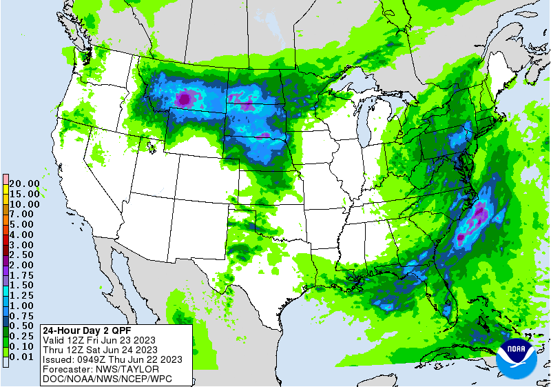
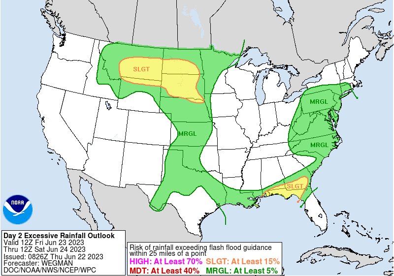
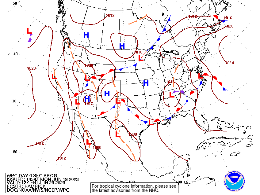
Excessive Rainfall Discussion
NWS Weather Prediction Center College Park MD
430 AM EDT Thu Jun 22 2023
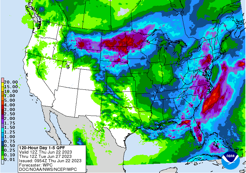
Day 2
Valid 12Z Fri Jun 23 2023 - 12Z Sat Jun 24 2023
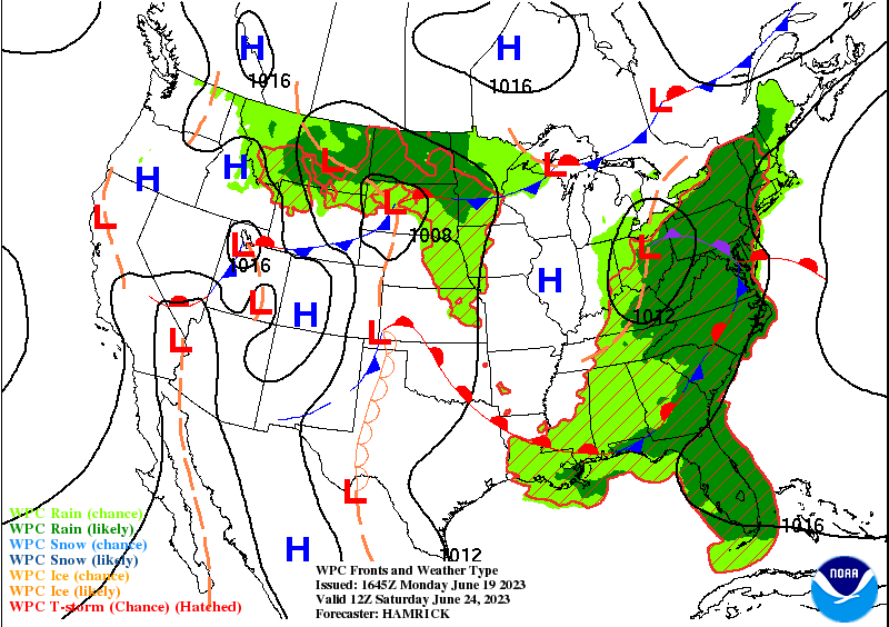
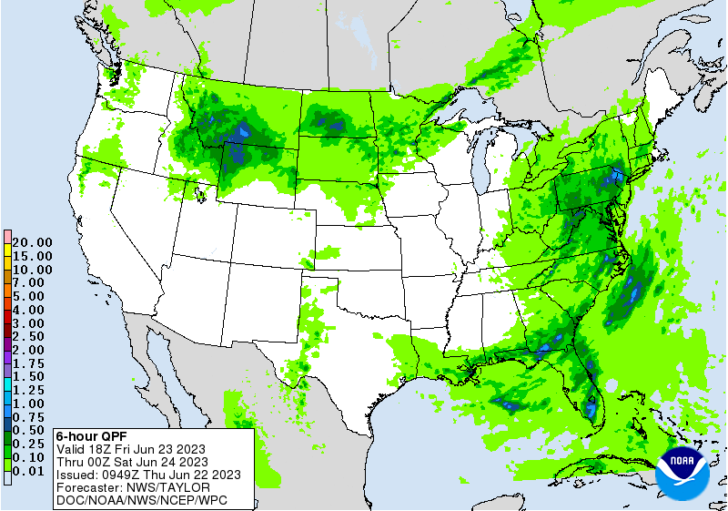
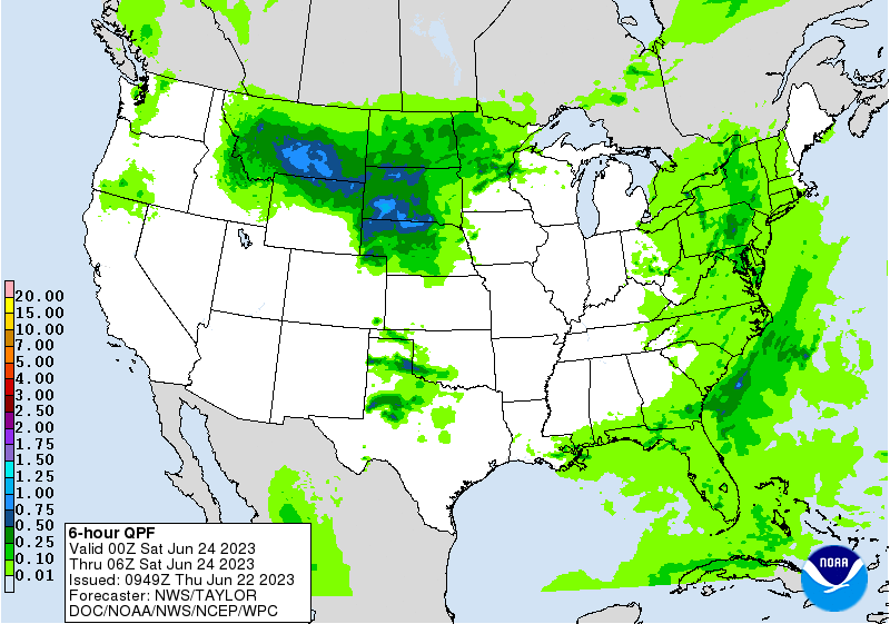
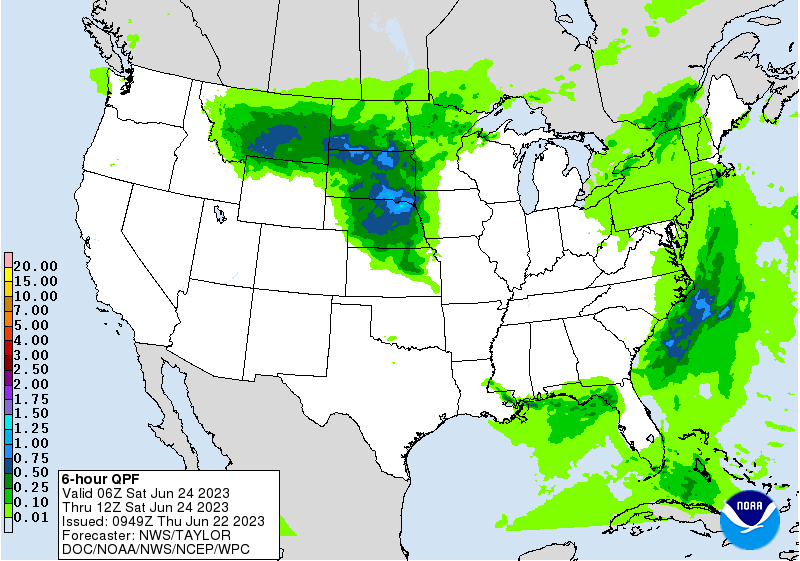
...THERE IS A SLIGHT RISK FOR EXCESSIVE RAINFALL FOR PORTIONS OF
THE HIGH PLAINS AND THE FLORIDA PANHANDLE INTO SOUTHERN GEORGIA...
...Plains...
Impressive synoptic forcing will move into the northern Plains
Friday as a strengthening shortwave intensifies into a closed low
by Friday night. The flow aloft should be highly divergent with
dual left exit and right entrance upper jet support between 2
separate jet streaks. In the lower levels a developing low
pressure and associated frontal structure will provide plenty of
lower level convergence to go along with the mid and upper level
ascent. PWs are not off the charts anomalous, but still plenty
above average for late June. Thus many ingredients are coming
together to support a heavy rainfall event over portions of
Montana, Wyoming and the Dakotas. The magnitude of the flash flood
threat is likely going to come down to the placement of the low
level front and higher instability, and how progressive things end
up being. This does look like a pretty quick moving system, which
should put an upper bound on total rainfall potential.
Besides this area of the country having been abnormally wet over
the past 2 weeks, an LLJ bringing Gulf moisture northward into the
Dakotas, and perhaps a bit towards the west into MT, and some
instability being advected into the region, it will be interesting
how all of this interacts with the favorable upper level
environment. The guidance is hinting at portions of south central
MT, near Billings, where leeside troughing may locally amplify the
forcing and allow for more persistent heavy rains in the broad
southwesterly flow. The Dakotas will have the benefit of more
moisture, but being somewhat displaced from the best upper level
divergence, may see lesser amounts of rain, though any storms that
form over that area still have the potential to produce 2
inch/hour rainfall rates.
For the southern Plains, the typical afternoon showers and
thunderstorms will redevelop again Friday afternoon, but since
they will be a bit more isolated and less organized as the upper
level flow diminishes, the flash flooding risk is expected to be
more isolated as compared with previous days.
...Eastern U.S...
A low-end Slight risk area was introduced for all of the Florida
Panhandle and into southern Georgia with this morning's forecast
update. The stalled out front that has acted as a corridor of
forcing for storms the last several days will remain stuck in
place, as a drier air mass over central MS/AL/northern GA tracks
east on the north side of the front. Thus, the front will continue
to have a significant enough difference between the air masses on
either side of the front to continue to provide a source of
lifting. With those differences maximized, the winds on the
moisture-laden/stormy side of the front across the FL Panhandle
should allow the storms that form to be moving a bit more quickly
off to the ENE. This should result in less overall rainfall over
this area, despite the tendency for storms to backbuild.
Nevertheless, given the incredibly wet conditions already present
over this area, and the potential for another 1-3 inches of rain,
with those higher values falling in a short time remaining very
capable of resulting in additional flash flooding, think the
potential is high enough for a Slight Risk area.
Further north across the Mid-Atlantic, the upper level low will
begin to open up into a trough, but will become negatively tilted.
This will increase the overall southerly wind flow over the area,
allowing for faster storm movement, but the added lift from the
divergence associated with the trough will support storms capable
of producing heavy rainfall to 2 inches per hour. Given the still
overall dry conditions over much of the Mid-Atlantic from a few
months of abnormally dry conditions, think any instances of flash
flooding will be localized to urbanized and poor drainage areas.
Wegman
Day 2 threat area:
www.wpc.ncep.noaa.gov/qpf/98epoints.txt
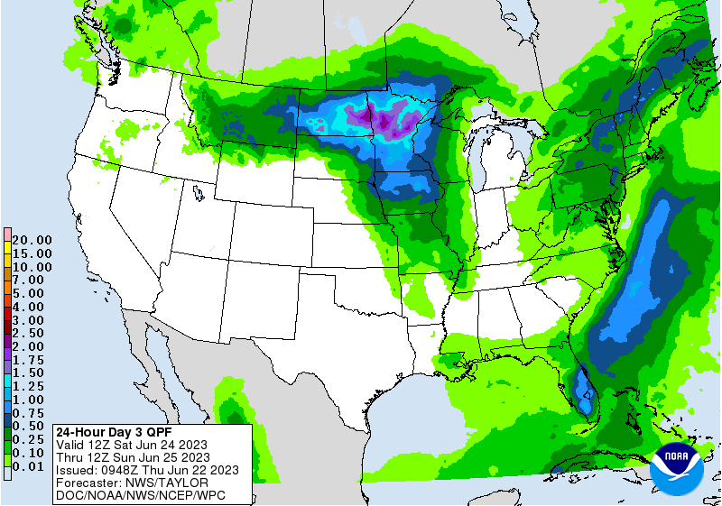
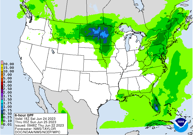
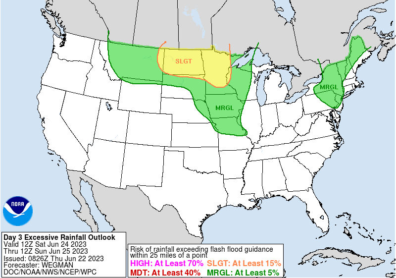
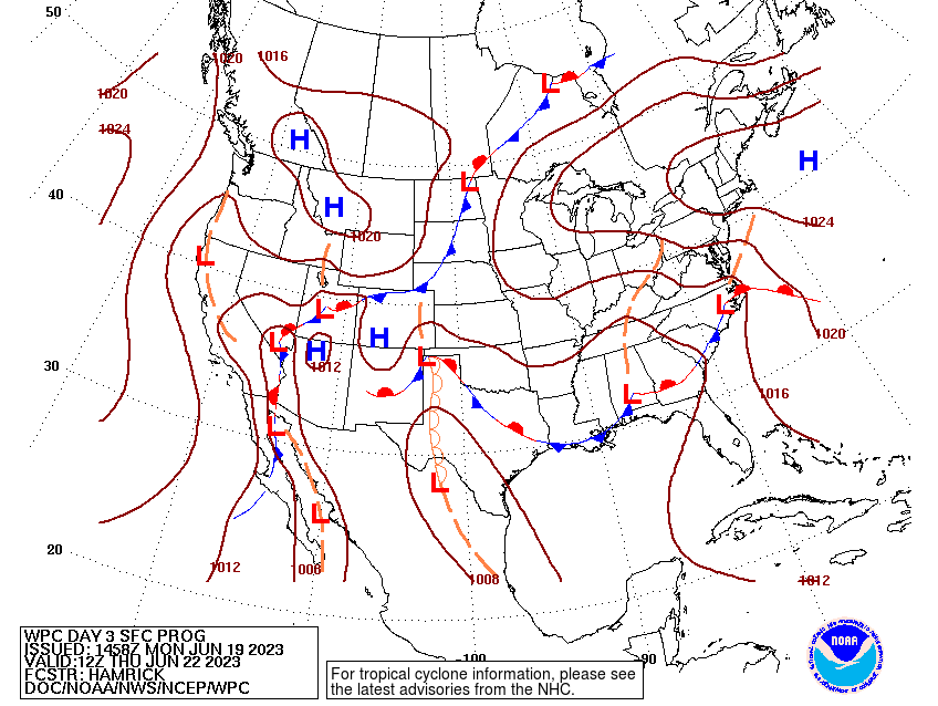
Excessive Rainfall Discussion
NWS Weather Prediction Center College Park MD
433 AM EDT Thu Jun 22 2023
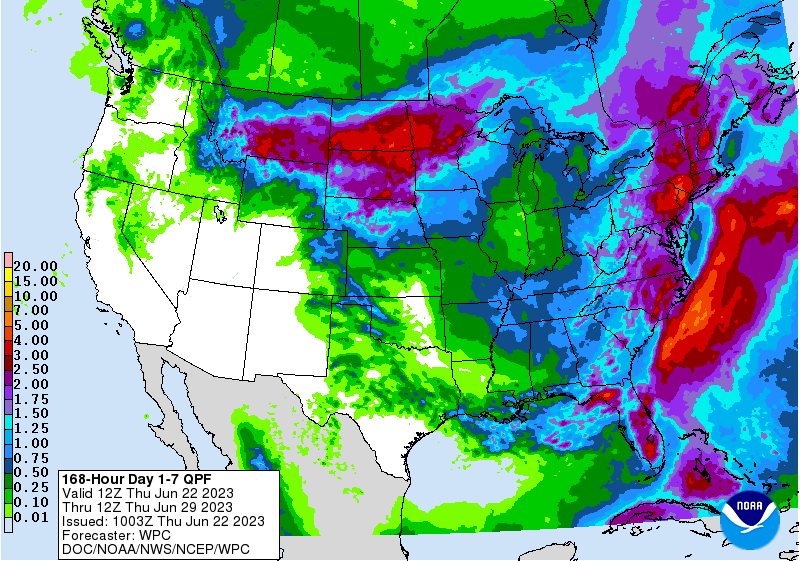
Day 3
Valid 12Z Sat Jun 24 2023 - 12Z Sun Jun 25 2023
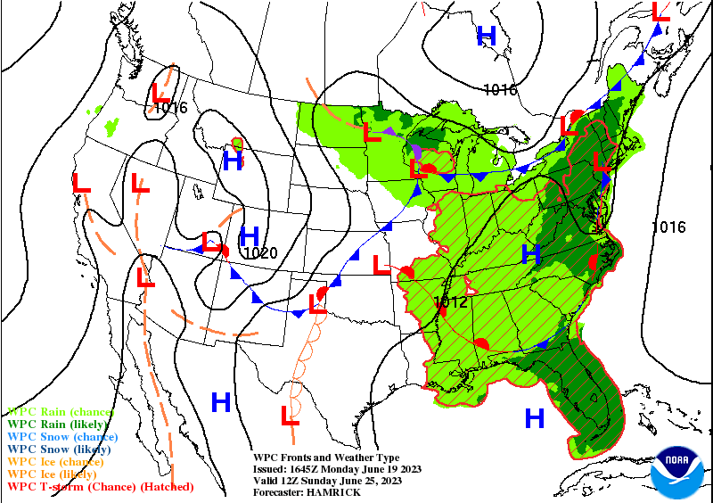
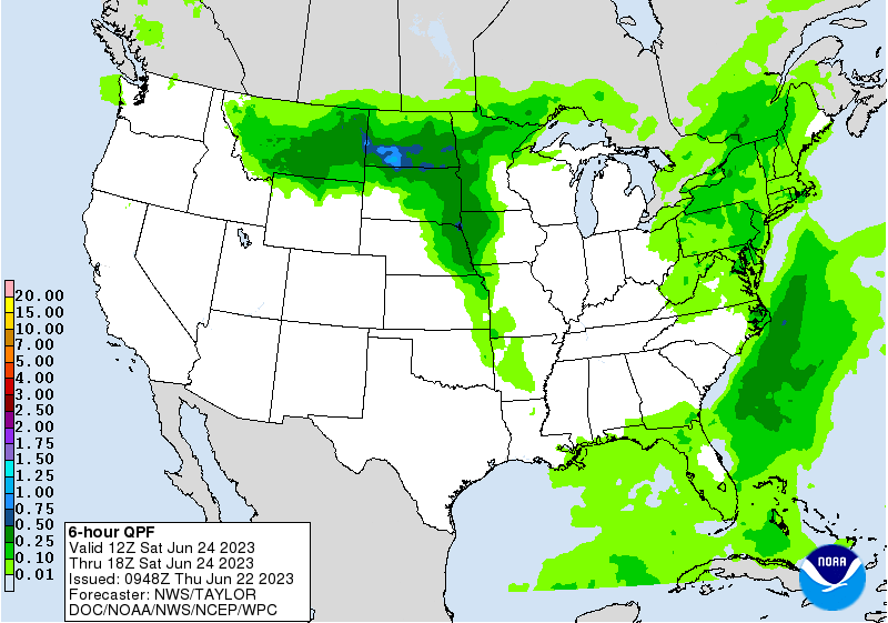
...THERE IS A SLIGHT RISK FOR EXCESSIVE RAINFALL FOR MUCH OF NORTH
DAKOTA AND MINNESOTA...
...ND/MN area...
A strengthening shortwave trough over south-central MT Saturday
morning will track east to western MN by Sunday morning. This
feature will allow the widespread area of rain, with some embedded
thunderstorms, to track east across the Slight Risk area on
Saturday. A slowly strengthening surface low will remain out ahead
of the shortwave, which will both draw moisture from the
ever-present LLJ northward, while also dragging the LLJ eastward
ahead of its cold front. The front will set off additional showers
and thunderstorms across IA/MO and WI, but since the front will be
progressive, so too will the storms along the front, so only
isolated flash flooding is possible, namely in urbanized areas.
With ND and MN still in the best forcing as the low wraps up,
training storms are likely to develop along the track of the low.
While soil conditions are dry from eastern ND and even drier
across northern MN, it's important to note that the abnormally
high atmospheric moisture (characterized by PWATs over 1.5 inches)
and favorable flow for training storms across this area may allow
for the heaviest rain that falls in this region to overcome the
antecedent dry conditions and result in flash flooding. If the
rain falls hard enough, then the dry soil can't absorb that much
water all at once, so there's increased runoff. Expect this to be
the case in the Slight Risk area Saturday.
...Northeast...
The upper level trough will continue to ever so slowly northeast
on Saturday, starting the day in the Ohio Valley and moving to
Central NY by Sunday morning. The trough will remain negatively
tilted, so the southerly LLJ of tropical Atlantic moisture will
continue pumping northward ahead of the the trough. Since the
forcing will be shifting north ahead of the trough, a Marginal
flash flooding threat will primarily focus from Philadelphia
northward. From northern New England and especially into western
ME, rainfall totals over the past 2 weeks are 200-300% of normal,
so the wet soils in this area will promote flash flooding,
especially on the southeast facing slopes of the White Mountains
of NH and ME. Very few changes were needed for this morning's
update, as the forecast remains on track.
Wegman
Day 3 threat area:
www.wpc.ncep.noaa.gov/qpf/99epoints.txt
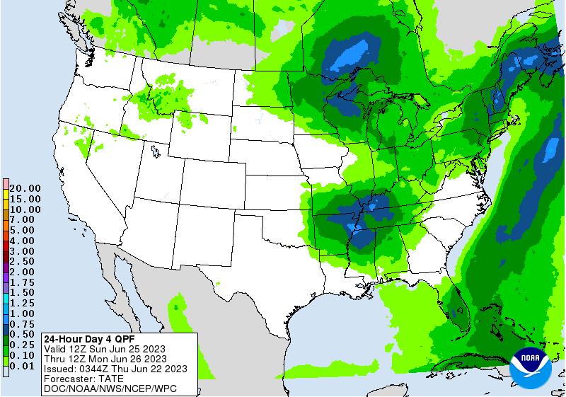
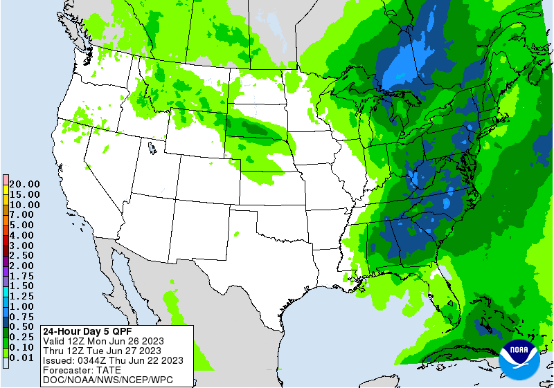
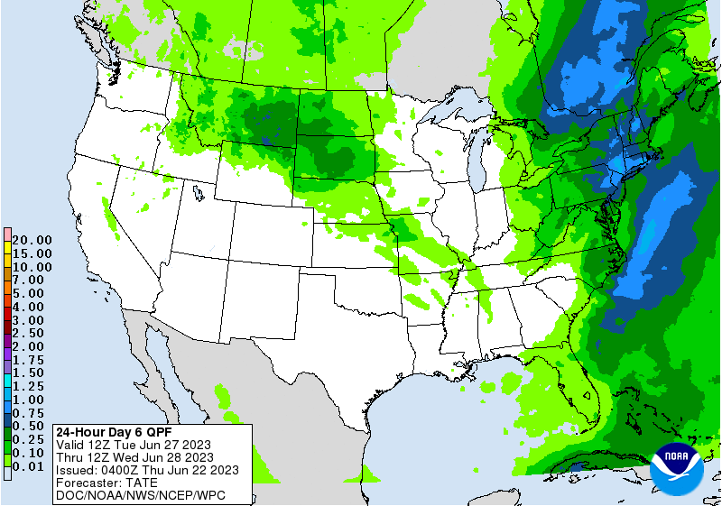
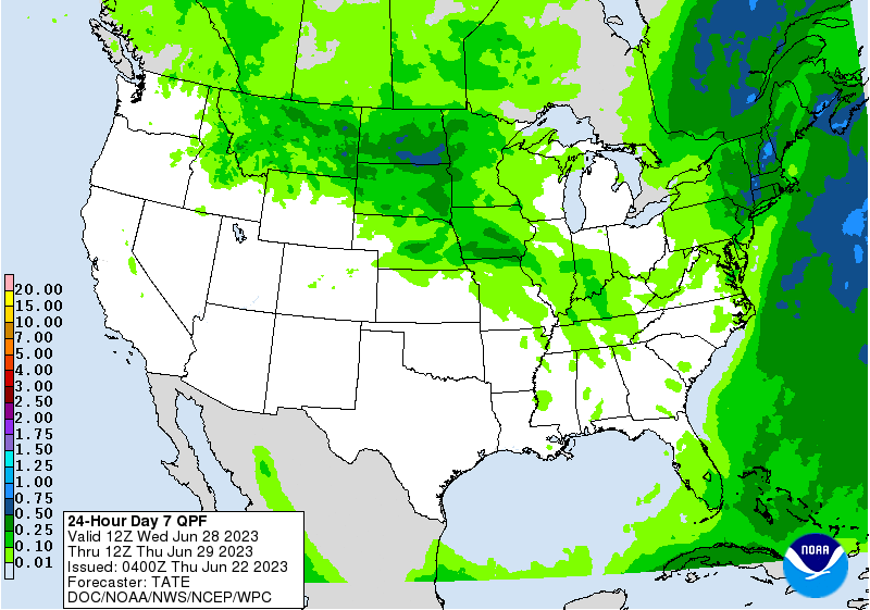
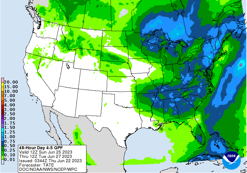
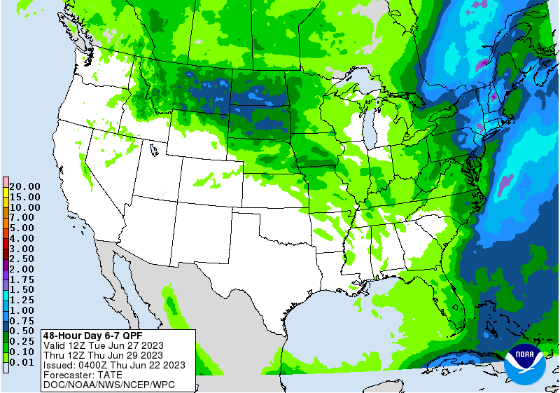
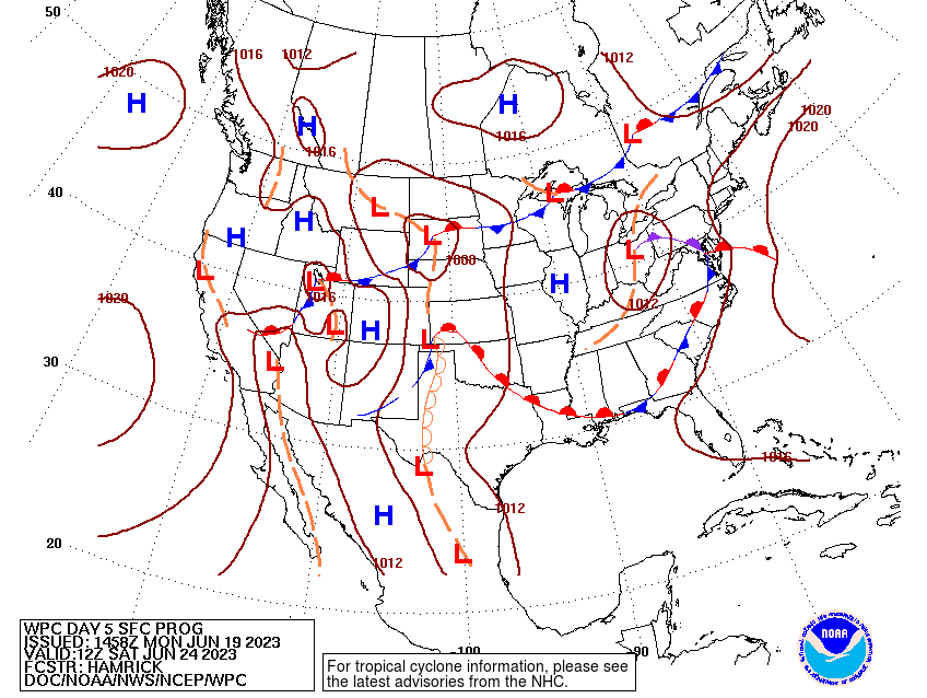
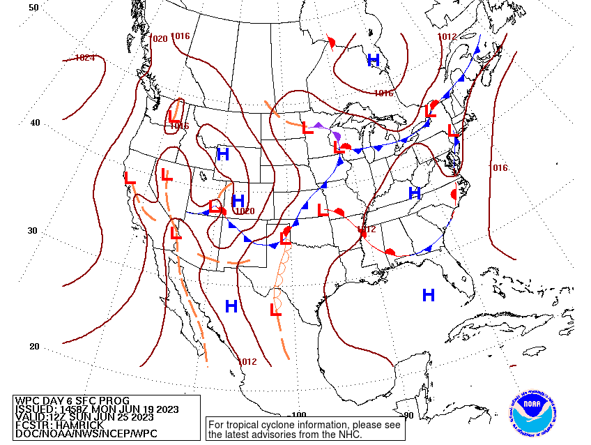
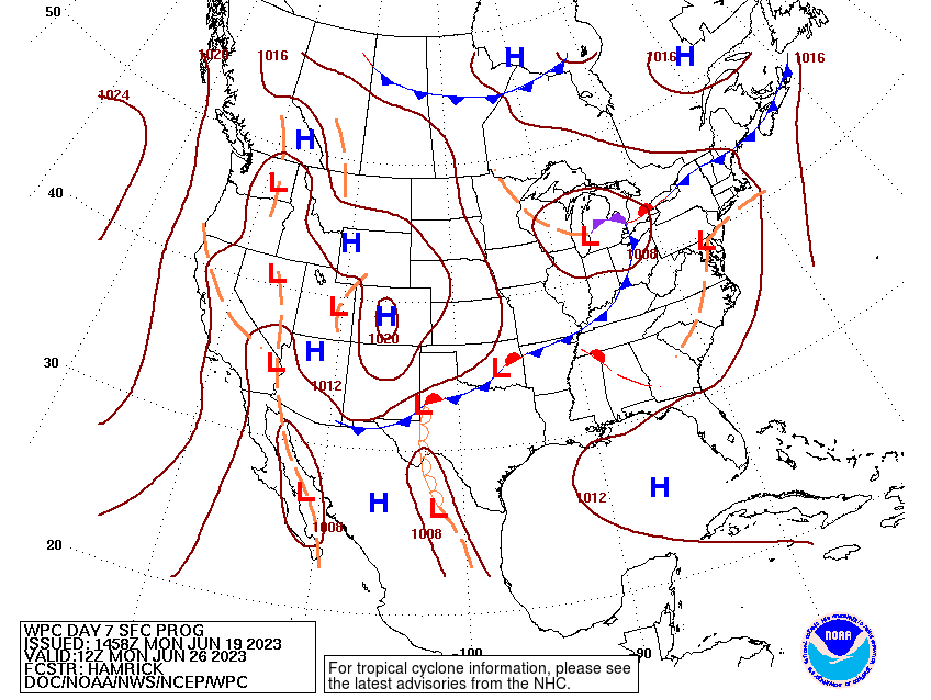
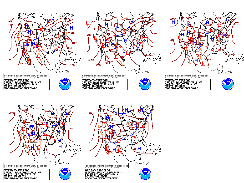
Extended Forecast Discussion
NWS Weather Prediction Center College Park MD
256 AM EDT Thu Jun 22 2023
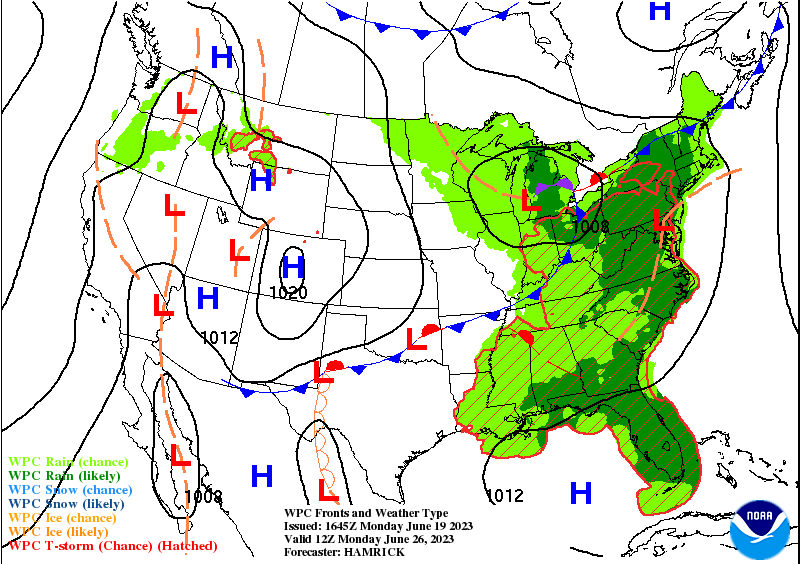
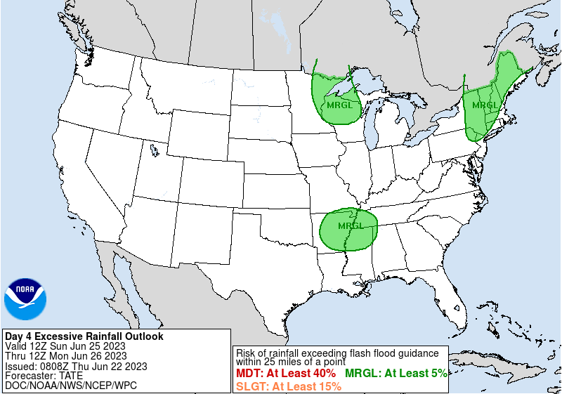
At the start of the period Sunday, a low pressure system aloft and
at the surface could cause some rain to linger across the Upper
Midwest, with locally heavy amounts possible given the good
dynamical support. Farther south, shower and storm chances will
likely also extend southward across the Mississippi Valley along
and ahead of the frontal system, and areas of the Mid-South may
see some heavy rain rates in potential mesoscale convective
systems near a dissipating warm front. Meanwhile, there may again
be a somewhat focused axis of rainfall across the northern
Mid-Atlantic region into the Interior Northeast on Sunday, with
some flooding concerns over areas with low Flash Flood Guidance.
All these areas have Marginal Risks of excessive rainfall in place
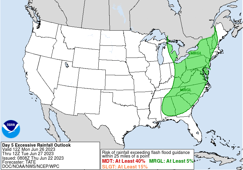
for Sunday-Sunday night. As the systems consolidate with time,
convection looks to overspread much of the East on Monday, with
severe weather a possibility too. A large Marginal Risk has been
introduced for much of the East as there may be locally heavy rain
with these scattered to widespread storms in an unstable
environment. Embedded Slight Risk(s) are possible as well in
future cycles if model guidance agrees on areas of focus for heavy
rain, especially if those areas have been greatly impacted by the
recent and short range heavy rains. By Tuesday and Wednesday, the
front should push slowly eastward with drying behind the front,
while additional rounds of rain and thunderstorms continue for the
Eastern Seaboard ahead of it. Meanwhile the next system into the
West will also allow scattered showers and storm chances to return
across parts of the Northwest and into the northern Rockies and
Plains next Monday-Wednesday.
In terms of temperatures, there is really no end in sight for the
excessive heat that has plagued particularly Texas/southeastern
New Mexico in recent days. In fact, into next week, temperatures
over 100F and heat indices much higher will continue expanding
east into the Lower Mississippi Valley. Several record
temperatures could be set or tied, as temperatures nearing or
exceeding 110 could again occur in western and southern Texas. The
Desert Southwest starts to see temperatures well over 100F next
week too, though not really anomalous for this typically hottest
time of the year there. As mean upper ridging expands farther
north, highs in the 90s are likely across the southern two-thirds
of the Plains and Mississippi Valley, with current forecasts
showing temperatures exceeding 100F into Oklahoma/Kansas/Arkansas
by Wednesday-Thursday. Meanwhile the West should see slightly
cooler than normal temperatures particularly for highs with the
bouts of upper troughing aloft. The East looks to be within a few
degrees of average for early summer, with a trend toward below
average by around 5-10 degrees for the Great Lakes region.
Tate
Extended Forecast Discussion
NWS Weather Prediction Center College Park MD
256 AM EDT Thu Jun 22 2023
At the start of the period Sunday, a low pressure system aloft and
at the surface could cause some rain to linger across the Upper
Midwest, with locally heavy amounts possible given the good
dynamical support. Farther south, shower and storm chances will
likely also extend southward across the Mississippi Valley along
and ahead of the frontal system, and areas of the Mid-South may
see some heavy rain rates in potential mesoscale convective
systems near a dissipating warm front. Meanwhile, there may again
be a somewhat focused axis of rainfall across the northern
Mid-Atlantic region into the Interior Northeast on Sunday, with
some flooding concerns over areas with low Flash Flood Guidance.
All these areas have Marginal Risks of excessive rainfall in place
for Sunday-Sunday night. As the systems consolidate with time,
convection looks to overspread much of the East on Monday, with
severe weather a possibility too. A large Marginal Risk has been
introduced for much of the East as there may be locally heavy rain
with these scattered to widespread storms in an unstable
environment. Embedded Slight Risk(s) are possible as well in
future cycles if model guidance agrees on areas of focus for heavy
rain, especially if those areas have been greatly impacted by the
recent and short range heavy rains. By Tuesday and Wednesday, the
front should push slowly eastward with drying behind the front,
while additional rounds of rain and thunderstorms continue for the
Eastern Seaboard ahead of it. Meanwhile the next system into the
West will also allow scattered showers and storm chances to return
across parts of the Northwest and into the northern Rockies and
Plains next Monday-Wednesday.
In terms of temperatures, there is really no end in sight for the
excessive heat that has plagued particularly Texas/southeastern
New Mexico in recent days. In fact, into next week, temperatures
over 100F and heat indices much higher will continue expanding
east into the Lower Mississippi Valley. Several record
temperatures could be set or tied, as temperatures nearing or
exceeding 110 could again occur in western and southern Texas. The
Desert Southwest starts to see temperatures well over 100F next
week too, though not really anomalous for this typically hottest
time of the year there. As mean upper ridging expands farther
north, highs in the 90s are likely across the southern two-thirds
of the Plains and Mississippi Valley, with current forecasts
showing temperatures exceeding 100F into Oklahoma/Kansas/Arkansas
by Wednesday-Thursday. Meanwhile the West should see slightly
cooler than normal temperatures particularly for highs with the
bouts of upper troughing aloft. The East looks to be within a few
degrees of average for early summer, with a trend toward below
average by around 5-10 degrees for the Great Lakes region.
Tate


